|
|
Maps and Cartography
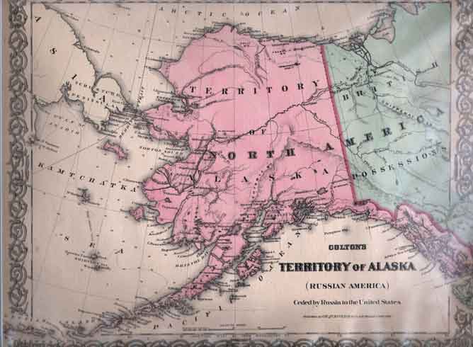
Item #: 130898 Territory of Alaska (Russian America) Ceded by Russia to the United States (1868)Early Map of the Territory of Alaska ( Russian America ), Ceded by Russia to the United States. $210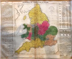
Item #: 130909 Map of England and Wales (1821)By: T. H. Palmer, printer Young & Dellcker, sc. Hand-colored copper engraving, folio size, 44 x 54 cm (17.25 x 21.5”). Taken from Lavoisne’s Atlas, 3rd American ed., 1821. ... $300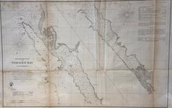
Item #: 130913 Preliminary Chart of Tomales Bay California, From a Trigonometrical Survey under the direction of A.D. Bache, Superintendent of the Survey of The Coast of the United States. No.23 (1861)By: Bowen & Co. lith. Philada. - Electrotype Copy No.1 by G. Mathiot USCS United States Coastal Survey of Tomales Bay in California. Gives Tides information, and Soundings of depth measured in feet. ... $225
Item #: 130919 Carte du Golphe du Mexique et des Isles de L”Amerique. Pour servir a l’Historie Generale des Voyages. (1754)By: M. Bellin, Ingr de la Marine Interesting and detailed map of Florida, the Gulf Coast, Central America, and the Caribbean. The map shows the route of Ponce de... $400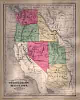
Item #: 81015 Map of Washington, Oregon, Idaho, Nevada, Utah and Arizon (1884)By: Stuart, Oliver J. - Stuart, Oliver J. $85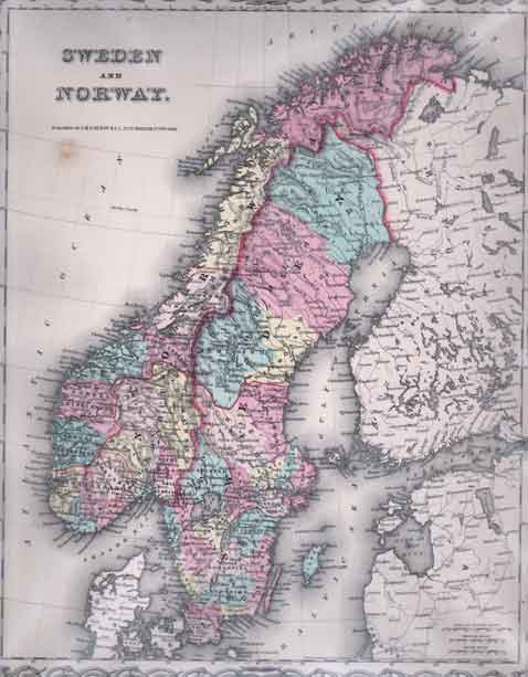
Item #: 81017 Map of Sweden and Norway (1856)$210
Item #: 81027 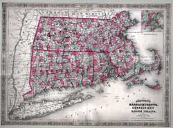
Item #: 81034 Johnson's Map of Massachusetts, Connecticut and Rhode Island by A.J. Johnson (1863)With townships identified. $225
Item #: 81037 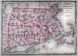
Item #: 81041 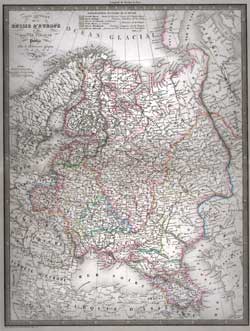
Item #: 81046 Carte Generale de la Russie d'Europe (1855)By: Louis Antoine A wonderful steel engraved map hand-colored in outline showing boundries, rivers, cities, towns, rivers, mountain ranges, etc. ... $260
Item #: 81050 
Item #: 81056 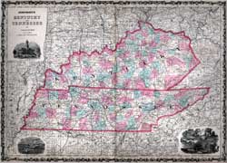
Item #: 81064 Johnson's Map of Kentucky and Tennessee (1863)$225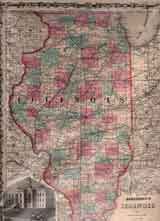
Item #: 81067 Johnson's Map of Illinois (1862)$225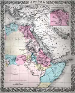
Item #: 81075 Map of North Eastern Africa (1856)By: Colton, J. H. Map of the North East section of Africa, including the Horn of Africa an an insert of the Delta of the Nile. Includes text page. $160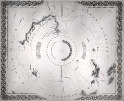
Item #: 81085 Map of Southern Regions (1855)Black and white map of Antartica (the Southern Regions, showing the routes of early explorers, bays, and mountain ranges. $100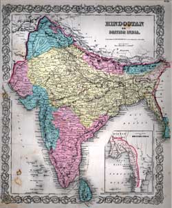
Item #: 81087 Map of Hindostan or British India (1856)Hand colored map of Hindostan or British India showing, cities, towns, rivers, mountain ranges, etc. $195
|