|
|
Maps and Cartography - Europe
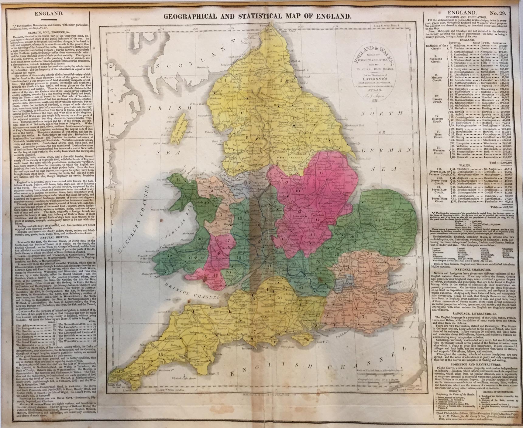
Map of England and Wales (1821)By: T. H. Palmer, printer Young & Dellcker, sc. Size: 16.75 H x 20.50 W inches Source: Lavoisne, M. “A Complete Genealogical, Historical, Chronological, and Geographical Atlas, being a General Guide to Ancient and Modern History: Exhibiting an Accurate Account of the Origin, Descent, and Marriages of the Principal Royal Families from the Earliest Authentic Records...” Philadelphia : M. Carey & Sons, 1821. Item #: 130909 Hand-colored copper engraving, folio size, 44 x 54 cm (17.25 x 21.5”). Taken from Lavoisne’s Atlas, 3rd American ed., 1821. Printed by T. H. Palmer, on Ramage’s Ruthven Press, and on J. & T. Gilpin’s Machine Paper. Signed, with text in the plate. Printed across the fold. Matted and sealed. Minor toning and foxing; else VG. $300 |