|
|
Maps and Cartography - Asia
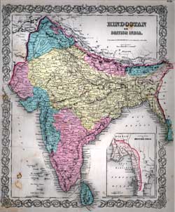
Item #: 81087 Map of Hindostan or British India (1856)Hand colored map of Hindostan or British India showing, cities, towns, rivers, mountain ranges, etc. $195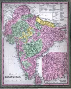
Item #: 81098 Map of Hindoostan (1850)Hand colored map of Hindostan published by Thomas Cowperthwait & Co. in Philadelphia, with an insert of the Delta of the Ganges,... $300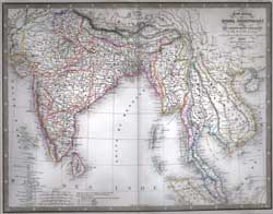
Item #: 81181 Carte Generale des Indes Orientales (1855)By: Louis Antoine A wonderful steel engraved map hand-colored in outline showing boundries, rivers, cities, towns, rivers, mountain ranges, etc. ... $260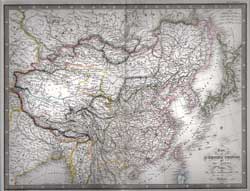
Item #: 81228 Carte de L'Empire Chinois et Du Japon (1855)By: Louis Antoine A wonderful steel engraved map hand-colored in outline showing boundries, rivers, cities, towns, rivers, mountain ranges, etc. ... $250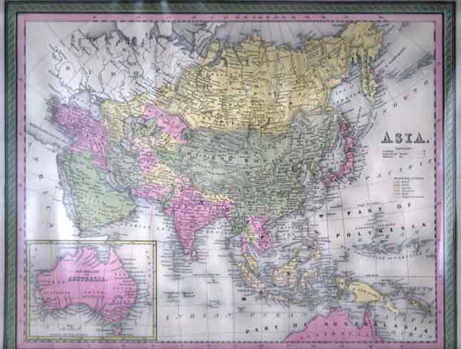
Item #: 90165 Map of Asia. (ca. 1848.)By: Thomas Cowperthwait Hand-colored lithograph. 31 x 39 cm in the plate. Titled in the plate. Australia inset. Fine. Matted, sealed. $275
|