|
|
Maps and Cartography

Item #: 81091 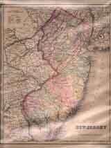
Item #: 81094 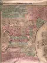
Item #: 81095 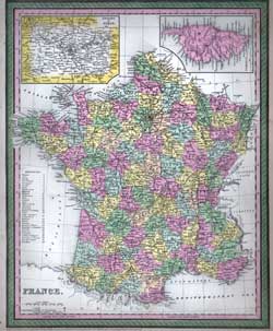
Item #: 81096 Map of France (1850)A fine hand-colored map of France showing each Department, major cities and towns, rivers, ports, provinces, lakes, etc. With an... $300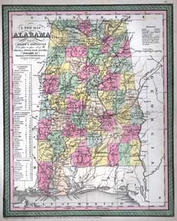
Item #: 81097 Map of Alabama (1850)$300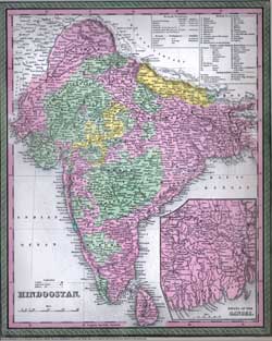
Item #: 81098 Map of Hindoostan (1850)Hand colored map of Hindostan published by Thomas Cowperthwait & Co. in Philadelphia, with an insert of the Delta of the Ganges,... $300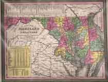
Item #: 81099 Map of Maryland and Delaware (1850)$395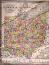
Item #: 81101 Map of State of Ohio (1850)$295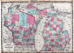
Item #: 81104 Johnson’s Map of Michigan and Wisconsin (1862)By: Johnson & Ward Double page map of Michigan and Wisconsin. Handcolored, with counties identified. $235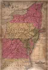
Item #: 81120 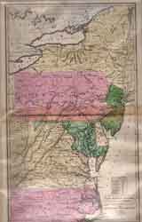
Item #: 81121 Map of The Middle States and Maryland & Virginia (1830)Map of the Middle States of the US circa 1830, notable for showing West Virginia as part of Virginia. $325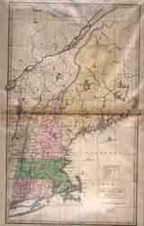
Item #: 81127 Map of New England States (1830)Ca. 1830; Map of New England States, Entered according to Act of Congress the 12th day of August 1830 by H.N.F. J. Huntington of... $340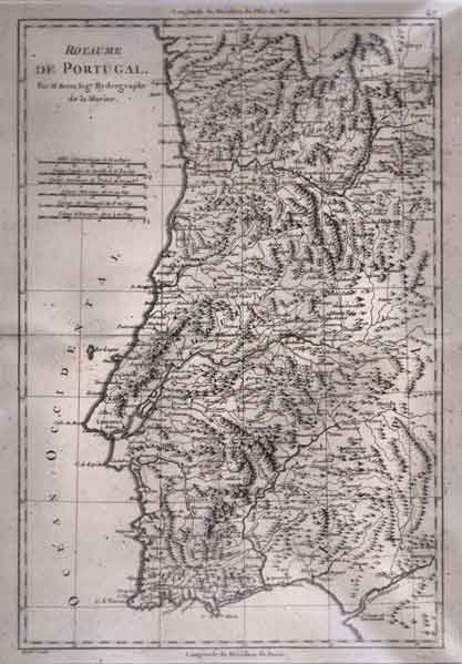
Item #: 81135 Map of Portugal (Royaume de Portugal) (1785)By: Andre, sculp. Rare map of Portugal showing cities, towns, rivers, lakes, mountain ranges, etc. using longitude du Meridian de Paris. $240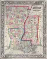
Item #: 81136 Map of Louisiana, Mississippi and Arkansas (1860)By: S. Augusta Mitchell Jr. Original, hand-colored steel-engraving. 35.5x28.5 cm (13.5x11”). $235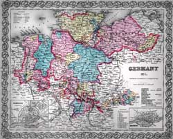
Item #: 81147 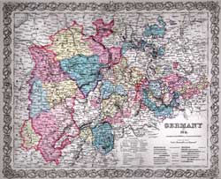
Item #: 81148 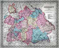
Item #: 81149 Map of Germany No.3 (1856)By: Colton, J. H. Hand-colored map showing boundries, rivers, towns, cities, mountains, etc. Includes text page. $175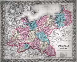
Item #: 81153
|