|
|
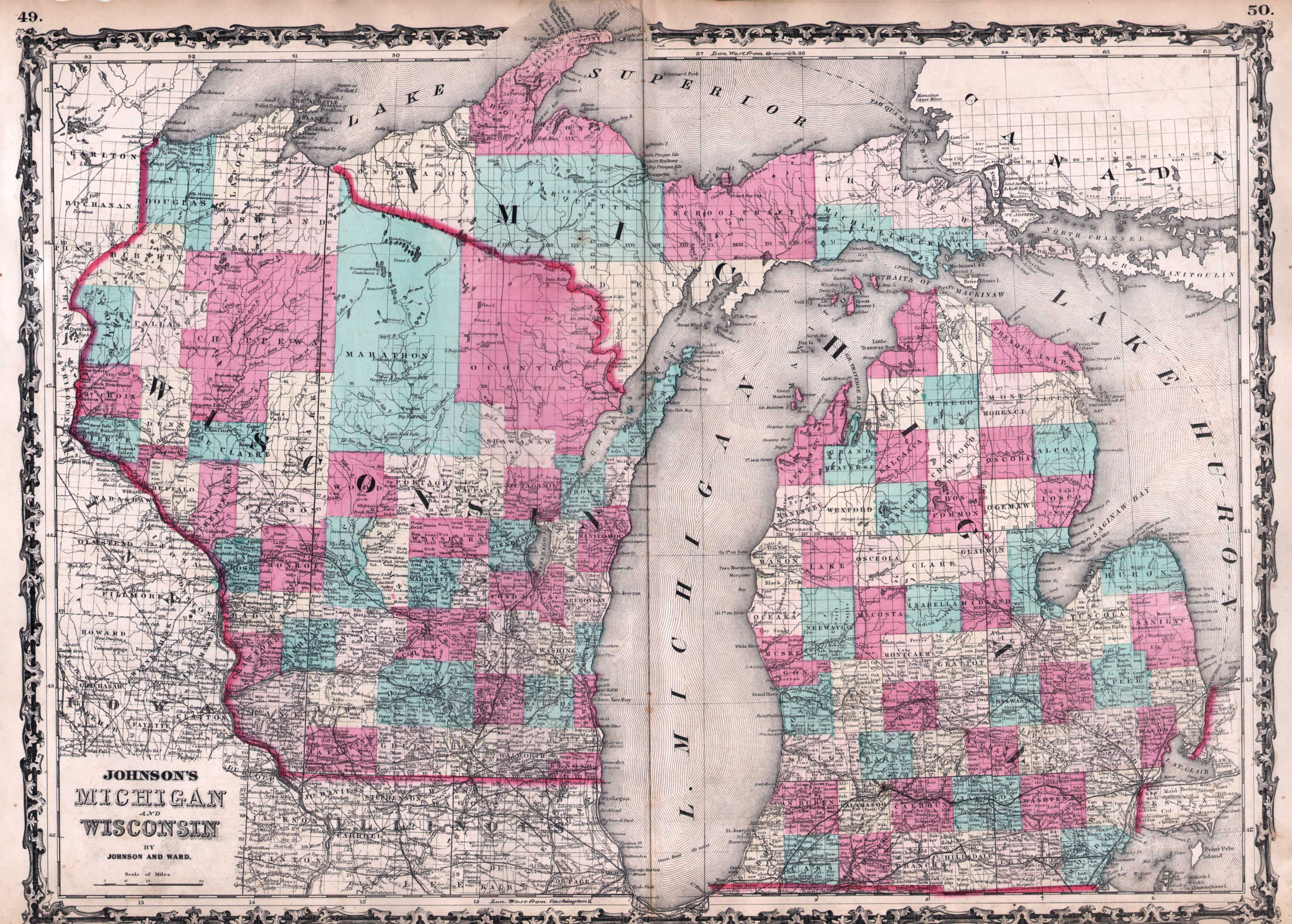
Maps and Cartography - USA
Johnson’s Map of Michigan and Wisconsin (1862)By: Johnson & Ward Size: 17.50 H x 24.50 W inches Source: Johnson’s New Illustrated (Steel Plate) Family Atlas, with Physical Geography, and with Descriptions Geographical, Statistical, and Historical... Maps Compiled, Drawn, and Engraved under the Supervision of J. H. Colton and A. J. Johnson. New York: Johnson and Ward. Item #: 81104 Double page map of Michigan and Wisconsin. Handcolored, with counties identified. $235 |